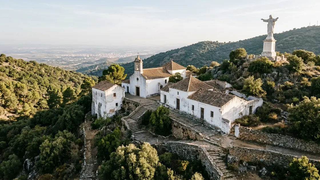

Las Ermitas is a hillside religious complex on the foothills of Sierra Morena, about 15 km from Córdoba, built around 13 hermitages, a small church and a Sacred Heart statue that is lit at night and seen from much of the city. It is a walk and a viewpoint more than a monument you tour. Go for the 2.7 km Cuesta del Reventón trail and the panorama at the top, and treat the buildings themselves as something you see from outside.
What Las Ermitas is
The Junta de Andalucía describes Las Ermitas as a place of religious character founded in 1699, made up of 13 hermitages, the Church of Nuestra Señora de Belén and a large sculpture of the Sacred Heart. A university heritage blog dates the story slightly later, to 1703 and the first hermitage built by Brother Francisco de Jesús, a Córdoba native. The two sources disagree and this page does not pick between them.
The place is also called the Desierto de Belén. "Desierto" here means solitude and calm, not sand. The blog adds that Brother Francisco persuaded Bishop Pedro de Salazar to cede land that some hermits already lived on, and that the first hermitage is today's church, whose first Mass was held on 11 July 1709.
The hermits and the Carmelites
The hermits fed the needy who climbed up to them. After the last of them, the complex was handed to the Discalced Carmelites, who share a similar spiritual model and still live there. That matters for visiting: it is a working religious community, not a museum.
Save your camera for the Balcón del Mundo
The lookout is where the views are: the Córdoba campiña, the Subbetic ranges and, on clear days, the Sierra Nevada. Choose a clear day, since the far view depends on it.
The Cuesta del Reventón walk
The Junta's trail leaflet describes the Cuesta del Reventón route, the main way up on foot. Before cars, walking was the usual way to reach Las Ermitas.
- Length: 2.7 km, linear rather than a loop.
- Time: about 1 hour 20 minutes.
- Difficulty: medium.
- Height: lowest point 310 m, highest 469 m, a maximum difference of 159 m.
- Start: 37º 54' 48" N, 4º 49' 12" W, which are the coordinates used on this page.
The cost of a short route is the climb. Take water, and do not read "2.7 km" as an easy stroll.
Getting to the start
By car, the leaflet sends you from El Brillante towards the Parador de la Arruzafa, then up Calle de Las Ermitas to the popular platform where you can leave the car. There is no parking set up at the start of the trail, though there are nearby places where it can be left. The same road passes Arruzafa, which the leaflet notes was an 8th-century country estate of Abd al-Rahman I.