Outdoor Córdoba
Sierra, dehesa, limestone canyon
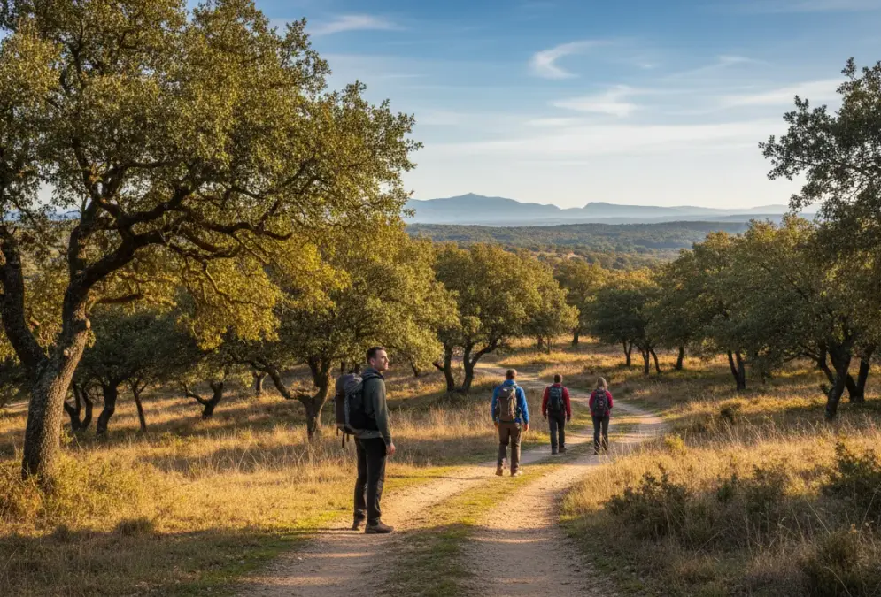
Within an hour of Córdoba city, the landscape shifts into something genuinely wild. Three natural parks cover hundreds of thousands of hectares — Iberian lynx, griffon vultures, the highest peak in the province, ancient pilgrimage roads. City-break hiking doesn't usually look like this.

Written by
María Fernanda González Ten years covering Córdoba's UNESCO heritage sites, sourcing from Junta de Andalucía documentation.
Published
Updated
Most visitors to Córdoba spend their time within the old city walls: the Mezquita-Catedral, the Judería, the flower-filled patios. That is a reasonable use of a few days. But hiking near Córdoba is a different proposition: three natural parks in Córdoba province sit within 80 kilometres of the city centre, covering limestone highlands, cork oak dehesa, and pine-forested sierra. None requires more than an hour's drive.
Each park has a distinct character. To the southeast, the Sierras Subbéticas climb to La Tiñosa at 1,568 m, the highest point in the province, with a UNESCO World Geopark designation for its fossil-rich limestone geology. Griffon vultures work the thermals above the gorges; Bonelli's eagles nest in the cliffs. Forty-five kilometres west, the Sierra Morena forest of Sierra de Hornachuelos stretches across rolling holm oak and cork oak dehesa along the Guadalquivir corridor, with imperial eagles overhead year-round. To the north, the Sierra de Cardeña y Montoro is one of Andalusia's last strongholds of the Iberian lynx, critically endangered until the early 2000s and now slowly recovering. Iberian wolves also pass through.
Spring (April to May) and autumn (September to November) are the seasons that work. Summer temperatures reach 40°C in the valley and barely ease above 1,000 metres, making anything longer than an early-morning walk a real heat risk. This guide covers the three parks in detail, the specific trails worth knowing at each, how to get there without a hire car, and what to bring on the trail.
Hiking near Córdoba — at a glance
- Closest park
- Sierra de Hornachuelos — 45 km west
- Difficulty range
- Easy (Vía Verde) to Hard (La Tiñosa)
- Best hiking season
- April–May and September–November
- Natural parks
- 3 parks within 80 km of the city
- Summer warning
- July–August temperatures can exceed 40°C
In this guide
The three natural parks
Each park sits in a different direction from the city and has a distinct character. Together they cover the main landscape types of the Córdoba province: limestone highlands, Sierra Morena dehesa, and pine-forested sierra.
UNESCO World Geopark 60–80 km from Córdoba
Moderate to Hard
Sierras Subbéticas Natural Park
The most dramatic landscape in Córdoba province. The limestone plateau rises to La Tiñosa (1,568 m) — the highest point in the province — with views stretching across three provinces on a clear day. Griffon vultures ride the thermals overhead; golden eagles nest in the gorges below. The park also sits at the edge of the Subbética white towns cluster, so you can combine a serious hike with a stop in Priego de Córdoba or Zuheros.
Best for: Serious hikers, birdwatchers, geology enthusiasts
Highlights
- La Tiñosa peak (1,568 m)
- One of Spain's largest griffon vulture colonies
- Scenic limestone gorges and canyons
- Visitor centre at Santa Rita, Cabra
Gateway: Priego de Córdoba
Area: 32,056 ha
Sierra Morena 45–50 km from Córdoba
Easy to Moderate
Sierra de Hornachuelos Natural Park
West of Córdoba city, this park covers the rolling dehesa forests of the Sierra Morena — holm oak and cork oak woodland that opens onto the Guadalquivir river valley. Imperial eagles and griffon vultures are common year-round. The trails are gentler here than in the Subbéticas, which makes it the right choice for families or anyone who wants a full day outdoors without technical difficulty.
Best for: Family-friendly hikes, birdwatchers, nature photographers
Highlights
- Holm oak and cork oak dehesa
- Guadalquivir River valley views
- Imperial eagles and griffon vultures
- Easy, well-marked trail network
Gateway: Hornachuelos
Area: 67,202 ha
Iberian Lynx Refuge 50–60 km from Córdoba
Moderate
Sierra de Cardeña y Montoro Natural Park
North of Córdoba city, this park is one of the last strongholds of the Iberian lynx — critically endangered and now slowly recovering thanks partly to reserves like this one. Iberian wolves also pass through. The pine forests and Mediterranean scrubland make for atmospheric walking, and the GR7 long-distance trail runs through the park, connecting it to the wider Andalusian route network.
Best for: Wildlife enthusiasts, serious hikers, lynx watchers
Highlights
- Iberian lynx sightings possible
- Iberian wolf presence
- GR7 long-distance trail access
- Pine forest and Mediterranean vegetation
Gateway: Cardeña
Area: 38,449 ha
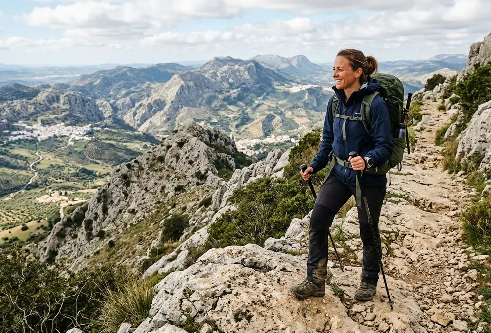
La Tiñosa (1,568 m) — the highest point in Córdoba province — is a full-day commitment. Spring and autumn are the windows that work.
Trails worth knowing
These are the routes that come up most reliably when you talk to people who hike regularly in Córdoba province. Difficulty ratings assume a reasonable base level of fitness.
La Tiñosa Summit Trail
Hard 15–20 km circuit 6–8 hours 1,568 m
The highest point in Córdoba province, with panoramic views across three provinces. A full day out for fit hikers — go in spring or autumn, carry water, and check the weather before you set off. The summit is often windy even when the base is warm.
Vía Verde de la Subbética
Easy to Moderate 18–25 km 5–7 hours Mostly flat
A former railway line converted to a greenway, running through olive groves and limestone countryside. Flat enough for families and cyclists, long enough to feel like a proper day out. You can tackle sections of it rather than the full route.
Sendero del Bembézar
Easy 13 km 3–4 hours Gentle
A riverside walk along the Bembézar in Sierra de Hornachuelos. The river corridor draws an impressive variety of birds — bring binoculars. Good for a half-day without needing a full expedition mindset.
Cerro de la Cruz Trail
Moderate 8–10 km round trip 3–4 hours Scenic ridge
Views of the Guadalquivir river from the hills above Montoro. A manageable half-day hike with rewarding scenery that most visitors to Córdoba never reach.
Camino Mozárabe de Santiago
Moderate to Hard Multi-day Several days Varied
The ancient pilgrimage route that passes through Córdoba province on its way to Santiago de Compostela. You can walk just a section or commit to the full route. Either way, the path uses old Roman and medieval roads through landscape that has changed surprisingly little.
Cañón del Río Bailón
Moderate 12 km loop 4–5 hours ~550 m gain
The trail follows the Río Bailón through a limestone gorge before ending near the Cueva de los Murciélagos, a protected natural monument you can visit with advance booking. Zuheros village is at the trailhead — park there and walk down into the canyon rather than trying to drive closer. A permit is required for the gorge section; get it online before you go, it takes two minutes and the fine for not having one is not worth it.
Sierra de Córdoba — trails near the city
These four named routes start from Trassierra, less than 30 minutes from Córdoba city centre by car. No need to drive an hour to a natural park — the Sierra de Córdoba foothills offer real mountain walking within easy reach.
Spring weekends (March–May) see heavier parking around Trassierra. Leave early or add 20–30 minutes to your estimate.
SL-A 93 — Las Ermitas
Moderate 9.16 km loop 3 h +316 m
A classic starting from Santa María de Trassierra: holm oaks, viewpoints, and a pass through the Hermitages sector. Well-marked trail, perfect for a half-day. Parking at the Trassierra picnic area.
Sendero fluvial Arroyo Bejarano y Baños de Popea
Easy to Moderate 6.56 km loop 3 h 15 Low to moderate
A valley floor walk along riparian vegetation with seasonal waterfalls. Passes the Baños de Popea — particularly pleasant in spring when the water is running. Expect muddy stretches after winter rain on the stream-side sections.
PR-A 211 — Circular de Trassierra
Moderate 14.5 km loop 5 hours +215 m
A large forest loop around Trassierra through chestnut groves and open dehesa. Consistent gradient, no technical sections — the right choice for a full day out without committing to serious altitude.
PR-A 343 — Vereda de Trassierra
Moderate 11.3 km (one way) 4 h 30 +360 m
A traverse from Córdoba city into Trassierra — the most direct route from urban streets into genuine sierra. One rocky, steep section near Cortijo de la Huerta de la Gitana. Walk city-to-sierra for the view payoff at the top.
Spring hiking — what to know
April and May are the best months for hiking near Córdoba. The conditions are good, but they come with specifics worth knowing before you set off.
Spring conditions (March–May)
Wildflowers
March–April is peak flowering — asphodels, cistus, wild orchids at altitude depending on winter rainfall. Sierra de Córdoba foothills and the Subbéticas plateau are best.
Temperatures
Morning starts at 10–16°C, rising to 20–28°C by afternoon in April–May. Start by 08:00 to hike cool; the heat builds quickly after midday.
Trail conditions
River-valley trails (Bejarano/Baños de Popea) may be wet and slippery after late winter rain. Check conditions the day before for any route near a stream.
Best window
08:00–13:00 for comfortable hiking and best light. Afternoon sun becomes sharp by May.
Spring safety checklist
- Water: 2 litres minimum per person, even on short loops — air is drier than it feels.
- Departure time: Start before 09:00 in April–May to avoid rapid temperature rise.
- Sun protection: SPF 50+, hat, UV sunglasses — Andalusian spring sun is intense above 400 m.
- Wildlife: Stay on trail; nesting season for birds runs March–June. Keep your distance from all fauna.
- Fire risk: No open flames or cigarettes in or near the parks. Call 112 immediately if you see smoke.
Beyond hiking
Walking is the most accessible option, but the parks and river corridors support a wider range of activities.
Kayaking and canoeing
The Guadalquivir near Montoro runs well from October to May. Several operators offer kayak hire and guided river trips. The gorge sections are the most scenic.
Birdwatching
The Sierras Subbéticas holds one of Spain's largest griffon vulture colonies; Bonelli's eagles and peregrine falcons nest in the cliffs alongside. Imperial eagles are year-round at Hornachuelos and Cardeña. Spring migration (March–May) brings the widest variety.
Wildlife watching
Sierra de Cardeña y Montoro is one of Andalusia's main Iberian lynx refuges — sightings require patience and early mornings, but they happen. Iberian wolves also pass through the park, along with otters along the river sections.
Mountain biking
The Vía Verde de la Subbética is the most accessible option — a flat former railway suitable for most riders. The Sierra Morena trails require a hardtail at minimum and some off-road experience.
Rock climbing and via ferrata
The limestone cliffs of the Sierras Subbéticas attract climbers from across Andalusia. Several via ferrata routes have been developed in the gorges around Priego de Córdoba. Gear hire is available locally.
Pilgrimage route
The Camino Mozárabe de Santiago passes through Córdoba province on ancient Roman and medieval roads. Walking even a short stretch gives a different sense of the landscape than a day hike — slower, more continuous, with villages spaced across the route.
Natural pools and river swimming
From late June through August, trail hiking becomes dangerous during the day. The Sierra Morena reservoirs and river pools are the practical alternative: cold water (17–24°C depending on the site), free entry, and 30–60 km from the city. All require a car.
Early mornings are the window. By 11am the approach roads are busy and the sun is strong. These are local spots — no lifeguards, no changing rooms, limited infrastructure. Bring everything you need.
Embalse de Navallana
30–35 km from Córdoba 20–24°C in July Free
The closest reservoir to the city. Low, sandy banks make entry easy; popular with local families on summer weekends. Arrive before 10am to find parking without difficulty. Good for an early-morning swim before the day heats up properly.
Access: Car — A-431 direction Montoro, then local road
Río Bembézar — river pools
50–55 km west 17–20°C Free
Native woodland shades the river corridor, keeping the water noticeably cooler than the open reservoirs. Several calm stretches are accessible along the Sendero del Bembézar trail — the combination of a short walk and a swim in the river makes the best use of a summer morning.
Access: Car — within Sierra de Hornachuelos Natural Park, near Hornachuelos
Embalse de la Breña
50–60 km west 22–27°C in August Free
Larger reservoir with multiple access points along the southern bank. Weekdays are uncrowded; summer weekends bring local day-trippers. The open water is warmer than the river pools — better for floating than for serious cooling.
Access: Car — A-3052 via Posadas
Swimming checklist
- No lifeguards at natural sites — swim with others, never alone.
- Arrive early: before 10am at Navallana; before 11am anywhere.
- Water shoes: rocky entry at most river sites.
- Bring everything: food, water, shade — no infrastructure at most spots.
- Check conditions: the Junta de Andalucía posts alerts when reservoirs restrict swimming after algae blooms.
See the natural pools activity page and AquaSierra water park for more options, and the Córdoba in summer guide for a full seasonal strategy.
Practical information
When to visit, how to reach the parks, and what to pack for a day on the trail.
When to go
Spring (Apr–May)
Wildflowers across the limestone plateau. Temperatures 15–25°C. Bird migration in full swing. The best all-round window for most hikers.
Autumn (Sep–Nov)
18–28°C, less crowded than spring, second migration season. Raptors begin moving south through the Subbéticas in October.
Summer (Jun–Aug)
Avoid if possible. 35–40°C in the valley; not much cooler on the trails. Heatstroke risk on anything longer than a short early-morning walk.
Winter (Dec–Feb)
Mild at lower elevations (8–15°C), cold and sometimes snowy at La Tiñosa. Fine for the river walks and dehesa trails, less reliable for the high Subbéticas.
Getting to the parks
By car (recommended)
The parks are spread across different directions from the city, and trailheads are rarely near bus stops. A hire car from Córdoba gives the most flexibility. Most trailheads have small car parks.
By bus
ALSA buses connect Córdoba with Priego de Córdoba, Montoro, and Cabra — the main gateway towns for each park. Journey times are 1–1.5 hours. Services are limited on Sundays.
Guided tours
OWAY Tours and Wildside Holidays both offer day trips into the natural parks from Córdoba city, including birdwatching and wildlife-focused tours with local guides.
What to bring on the trail
- Water — 2L minimum for a half-day, 3–4L for a full day
- Sturdy hiking boots with ankle support (essential for Subbéticas)
- Sun hat and high-SPF sunscreen (Andalusian sun is strong above 1,000m)
- Offline maps downloaded before you go (signal unreliable in valleys)
- Emergency number: 112 (works even without signal in most areas)
- Snacks and a mid-layer for La Tiñosa summit (always windy)
FAQ — hiking and nature near Córdoba
What natural parks are near Córdoba city?
The three main natural parks within day-trip range are Sierras Subbéticas (60–80 km southeast, UNESCO World Geopark), Sierra de Hornachuelos (45–50 km west, Sierra Morena), and Sierra de Cardeña y Montoro (50–60 km north, Iberian lynx refuge). All are accessible by car, with some bus connections to gateway towns.
When is the best time to hike near Córdoba?
Spring (April–May) and autumn (September–November) are the ideal seasons. Spring brings wildflowers and bird migration, with temperatures of 15–25°C. Autumn is quieter, with 18–28°C and the second migration season. Avoid June–August: temperatures regularly exceed 35–40°C and some trails become dangerous without early starts.
Can you see Iberian lynx near Córdoba?
Yes, though sightings are never guaranteed. The Sierra de Cardeña y Montoro Natural Park is one of the main Iberian lynx refuges in Andalusia. Dawn and dusk are the best times. The species was critically endangered as recently as the early 2000s and is now slowly recovering thanks to protection programmes.
What is the highest point in Córdoba province?
La Tiñosa, at 1,568 metres, is the highest peak in Córdoba province. It sits in the Sierras Subbéticas Natural Park, roughly 70 km southeast of the city. The summit trail is a 15–20 km circuit graded Hard, taking 6–8 hours. On a clear day the views extend across three provinces.
How do you get to the natural parks from Córdoba city?
A hire car gives the most flexibility — the parks are spread across different directions from the city. Buses run to Priego de Córdoba, Montoro, and Cabra, which are the main gateway towns. Several Córdoba operators offer guided nature and hiking tours, including OWAY Tours and Wildside Holidays.
Rent a car in Córdoba
Tours are selected for quality, not commission. We earn a small fee if you book — at no extra cost to you.
Most trailheads in the Sierra Morena and Subbética require a car. Compare rental rates from Córdoba.
Further reading
Sources and further reading
- Junta de Andalucía — Red de Espacios Naturales (opens in a new tab)
Official Andalusian government portal for natural parks, with trail maps, visitor centre information, and regulations for Hornachuelos, Subbéticas, and Cardeña y Montoro
- Turismo de Córdoba — Natural Parks (opens in a new tab)
Official Córdoba tourism information on natural parks, hiking routes, and outdoor activities in the province
- Sierras Subbéticas UNESCO Global Geopark (opens in a new tab)
Official Sierras Subbéticas Geopark website with geological information, trail guides, and visitor resources